
mount rainier national park
the most stunning hikes in mount rainier national park
The most stunning hikes in Mount Rainier National Park
Whether you are an avid hiker or just beginning to navigate the trails, Mount Rainier National park needs to be added to your bucket list. Mount Rainier stands at over 14,000 feet tall and can be seen towering above its surroundings from multiple viewpoints in Washington. There is something so special about staring at this mountain from afar and then being able to take in the scenery up close and personal. It is simply magnificent, below are some of our favorite trails around the mountain!
It is important to note that there are 4 different entrances to the park. The Paradise/ Nisqually entrance is in the southwest and is the most popular, Carbon River to the northwest, Sunrise to the northeast and Steven’s Canyon to the southeast. These will appropriately be delineated below! Also, this is a national park so there are no pets allowed. Please remember to leave no trace and leave the park better than you found it!

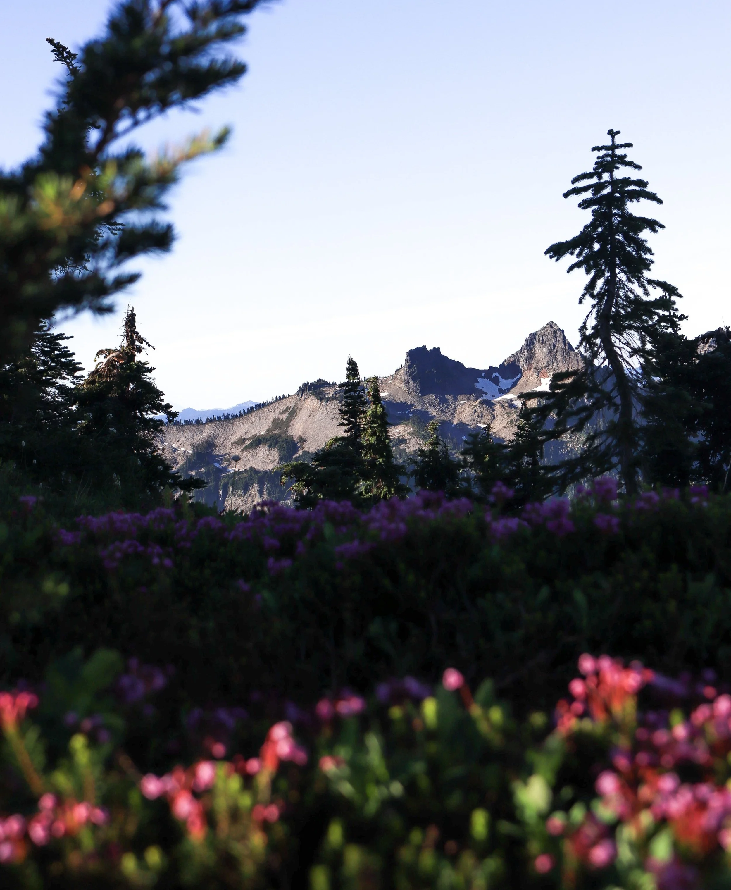
skyline trail loop
Length: 5.7 miles
Elevation: 1,768 feet
Route Type: Loop
Rated: hard
Find it here on all trails!
The skyline trail loop begins in Paradise through the southwest entrance of the park, right at the Jackson Visitor Center. This is the most popular trail in the park and I think that is due to both its accessibility and beauty! As you drive up the winding roads through the park, the mountain begins to peak out around every corner and you get your first taste of what this hike will be like - stunning.
I would recommend taking the trail counter-clockwise. The trail is paved at the beginning and you will find yourself initially hiking through lush forests. As the views open up you will be greeted with alpine meadows, glaciers, waterfalls and Mount Rainier herself! This trail truly has something for everyone. If you don’t want to do the full loop, Panorama Point is a great spot to stop, rest, and enjoy the views before heading down the mountain. There is a pit toilet in the summer with the most incredible views!
Pro-Tip: if you do the full loop, stop at the Myrtle Falls viewpoint on the way back.

bench & snow lakes
Length: 2.2 miles
Elevation: 450 feet
Route Type: out & back
Rated: moderate
Find it here on all trails!
The trailhead for this hike is located just past Reflection Lake, via the Paradise/ Nisqually entrance. Despite being rated as moderate, I think that this is a great hike with stunning views perfect for families visiting the park. The trail meanders through the forest with intermittent views of Mount Rainier and takes you to two beautiful lakes! During the summer, August in particular, the wildflowers were popping!
Pro-Tip: bring a suit to take a dip on a hot sunny day!
reflection lakes via mazama ridge
Length: 6.5 miles
Elevation: 1,770 feet
Route Type: loop
Rated: moderate
Find it here on all trails!
Okay, this might be my most favorite trail in the park! It starts at Reflection Lake (Paradise/ Nisqually entrance) and you climb up to Faraway Rock. I actually stopped here for a few minutes to finish watching the sunrise. Then you’ll get to Mazama Ridge which is much less crowded than the Skyline Loop, but still offer magical views. I found that in mid-August the alpine meadows along this trail were much more full of color and unique blooms! This trail also includes the wonderful Myrtle Falls and if you wish to include part of the Skyline Loop it is easily doable as this leads right back through Paradise/ Jackson Visitor Center and back down to Reflection Lake. The trail back down to Reflection Lake is via lower lakes trail.
Pro-Tip: start your hike at sunrise and watch it come up from Reflection Lake. On the perfect morning as the sun illuminates the mountain, the lake is glass and the reflection is crystal clear!

tolmie peak trail
Length: 5.6 miles
Elevation: 1,555 feet
Route Type: out & back
Rated: moderate
Find it here on all trails!
Hike to a fire lookout? Say less. Tolmie Peak trail is located at the Carbon River entrance. This entrance takes you down a long gravel road, but I wouldn’t say that 4x4 or high clearance is needed, though we did see a few cars fixing flat tires along the way. And there is no cell service, so make sure you are prepared!
The hike begins along the shore of Mowich Lake and takes up through the forest to where the trail actually intersects with the Wonderland Trail. Go left at the fork. The trail will meander up further to Eunice Lake, which is the lake that you will eventually see below once you reach the fire lookout! Make sure that you explore past the fire lookout as the trail continues along the ridge. I would say it is a very well maintained trail and fairly easy, which makes it extremely popular, especially on the weekend! Try to go during the week to avoid the crowds. We went on a Sunday at sunset in September & there were probably 50 people at the fire lookout with us - still one of the best views!
Pro-Tip: this hike is absolutely magical at sunset!

pinnacle peak trail
Length: 3.8 miles
Elevation: 1,023 feet
Route Type: out & back
Rated: moderate
Find it here on all trails!
The Pinnacle Peak Trail begins at Reflection Lake via the Paradise/ Nisqually entrance to the park. Don’t let the short trail fool you, the elevation gain will creep up on you quickly! I paired this trail with Mazama Ridge and took a break for lunch & refilled on water between the two at Reflection Lake. This is a well maintained trail, gravel at times, with lots of switchbacks. There is a rock pile at the end that you can climb up though there are signs saying that the trail is not maintained past this point. The views are exceptional, but remember to only do what you are comfortable and prepared for! It was a unique view of Mount Rainier from a bit further away!

reflection lake
No hike required, just drive up and enjoy the view!
Pro-Tip: arrive at sunrise for the perfect alpenglow.